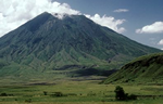
Swahili Phrases | Sign Our Guest Book | Emergency Services | Contact Us
Documentaries
Tourism in Tanzania
Medical & Health
QUICK Links
Great Rift Valley
Ol Doinyo Lengai, the only active volcano in Tanzania’s Great Rift Valley, last erupted in 1983. One of the world’s most remarkable geographical features, the Great Rift Valley is believed to have been formed centuries ago by tectonic plate activity. Most of Tanzania’s lakes were formed in this way, as was Kilimanjaro, Africa’s tallest mountain.
Location
Tanzania is bordered on the north by Kenya, Lake Victoria, and Uganda; on the east by the Indian Ocean; on the south by Mozambique, Malawi, and Zambia; and on the west by Democratic Republic of the Congo (formerly Zaire), Burundi, and Rwanda.
The country includes the islands of Zanzibar and Pemba, and other offshore islands in the Indian Ocean.
Topography
The landscape of mainland Tanzania is generally flat and low along the coast, but a plateau at an average elevation of about 1,220 metres (4,003 feet) constitutes the greater part of the country. Isolated mountain groups rise in the northeast and southwest.
The volcanic Kilimanjaro (5,895 metres/19,341 feet), the highest mountain in Africa, is located near the northeastern border. Zanzibar is the largest coral island off the coast of Africa. Pemba is some 40 kilometres (25 miles) northwest of Zanzibar. Both Zanzibar and Pemba are mostly low-lying.
Culture
Directory
News
Life Style
Statistics
Travels
Towns
Introduction || Background || Government || Economy || Communications & Military || Location & Topography || Rivers & Lakes || Environmental